IN PREP
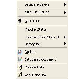
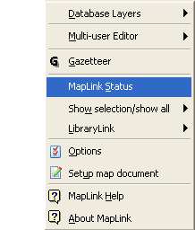
Database Layers
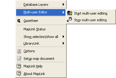
Multi-user Editor
The user can start and stop the Multi-user Editor from the Edit menu or from Multi-user Editor flyout on the XGArcApps menu. Note that the main ArcMap Editor menu also has these commands.
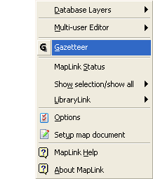
Gazetteer
The Mini Gazetteer flyout may be used to launch the Gazetteer. Note that the MapLink toolbar also has a button to launch the Gazetteer. The About Gazetteer option reports on the version of the Gazetteer.
MapLink Status
The user can view the current MapLink status at any point by going to the XGArcApps menu on the ArcMap menu bar, selecting the MapLink option and then selecting MapLink Status. This may be useful in troubleshooting - please copy this data into a text file if you encounter any problems when using the MapLink, this will help exeGesIS SDM to diagnose and resolve such problems.
The resulting XG Link Status window will provide information about the active record, including the active map layer, the active ID, current map and database transfer attribute values, and configuration settings. Please see 'MapLink status' for more detailed information about the MapLink Status.
Show Selection / Show All
The XGArcApps menu provides a 'Show Selection / Show All' pull-down menu to control the functionality of the Hide/Show Unselected Features button.
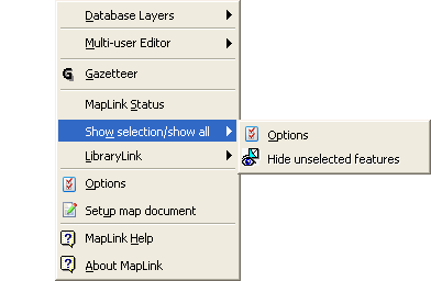
Options Selecting Options from the menu produces a dialog box which allows a choice of three possible modes of operation for this feature. The user can choose to hide unselected features in selectable layers according to the following criteria:
- only if there is a selection in the layer
- where there is a selection in any layer in the same group as the layer
- even when there is no selection in the layer
Selecting Show All Features from the menu will cause all features to be displayed regardless of the status of the Hide/Show Unselected Features button.
LibraryLink
The LibraryLink menu can be used to invoke LibraryLink or to get information about the currently installed version.
Options
The Options dialogue allows you to set the location of the configuration file (XGArcAppsEdit.ini; XGArcAppsLibLink.ini; XGArcAppsMiniGaz.ini) and the Connection and Command timeout settings.
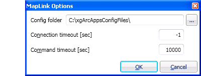
The configuration files control which layers in the map must be edited using the MapLink Multiuser Editor, LibraryLink configuration, and gazetteer configuration. These files may be installed on your local C: drive or a network drive. This allows for individual configurations or, if the files are in a location accessible by all users, shared configuration. The location for these files is specified during MapLink installation but if the files are moved the new location can be set using this dialogue.
Connection timeout
Command timemout
Setup map document
Map layers and feature classes can be given any name desired. The names must be mapped to the identifiers used in the application INI file. See Setting up the Map Document in the Admin guide for details.
Once the map document has been configured spatial data may be migrated to a variety of database products, or feature classes may be imported into the map document from a database.
MapLink Help
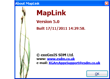
About MapLink
The About ArcMapLink window displays information about the MapLink control, together with details of the INI file that is being referenced, and the layers opened. This can be viewed at any point by going to the Tools menu on the ArcMap menu bar, selecting the MapLink option and then selecting 'MapLink Status'. Please note that changes made in the INI file will not take effect until the application is restarted.