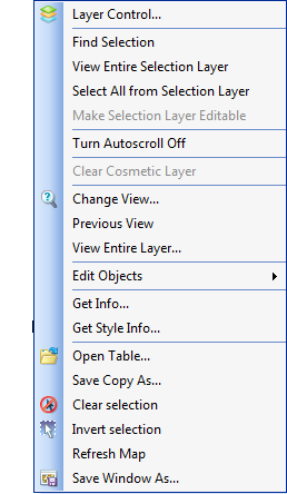
Right-clicking the mouse on the map produces the MapLink menu.

This is the standard MapInfo shortcut menu with the addition of 'Open Table', ‘Save Copy As’, 'Clear Selection', ‘Invert Selection’ and ‘Refresh Map’. More information on standard MapInfo functionality can be found in the MapInfo manuals.
‘Get Info’ returns the spatial definition of the currently selected object.
‘Get Style Info’ returns the style data for the currently selected object.
‘Open Table’ is used to open and display additional tables in the MapLink module. Tables opened in this way are opened only for the duration of the current session; they are not saved in the workspace.
‘Save Copy As’ can be used to save any layer or selection set as a new dataset (MapInfo table)
'Clear Selection' is used to clear any selected objects.
‘Invert selection’ Toggles the selection between the currently selected object and all unselected objects in the current layer. Note that this affects objects outside the current map view.
'Refresh Map' can be used during multi-user edit sessions to ensure that objects redraw after editing by another user.
'Save Window As' allows you to save the current view as an image file. You may save the file in a variety of formats and also set the size of the saved image. You also have the option to create a MapInfo layer from the data in the current view.
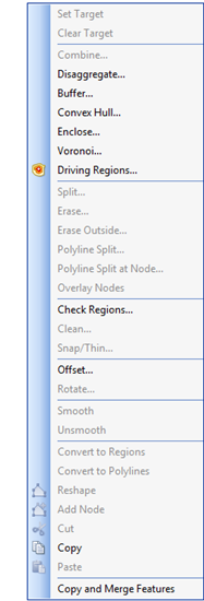
The 'Edit Objects' sub-menu appears as follows:
This is the standard MapInfo Edit Objects sub-menu with the addition of ‘Copy and Merge Features,’ ‘Reshape’, ‘Add Node’, ‘Cut’, ‘Copy’ and ‘Paste’ commands.

Different commands will be enabled or disabled depending on the context.
Once objects have been placed on the editing layer using the ‘Edit Selected Object’ button  , depending on whether they are points, lines or polygons, they can be moved, re-sized, re-shaped, combined or deleted.
Copy and Merge Features makes a copy of one or more objects from a different layer and appends it to the current active object. Multiple objects must be of the same geometry type.